Oueroa Pa: Age and Earthworks
Oueroa pa is not large by some other standards, but it is the overall exactness of the design that draws attention to the eye, particularly when the grass is short and the sun is highlighting the level terraces. It is very hard not to fall into deeper thoughts about its magnificence and origin.
The conversation of most visitors to the site turns to the similarities of structures in other countries, and particularly in England; so on this page it will be of interest to touch upon some of the points that I have come to understand over the years.
There is no intention to claim that Scots, Spanish, Celts, Australian Aboriginies, even Māori or others were in New Zealand first; for that line of thought is just continuing the very cycle or argument which I desire to be rid of. What we are taught at school, or what may be considered socially acceptable teachings are usually so very far removed from the truth, that it creates a lack of true identity and confusion. So approached from a different dimension, it may possibly be seen that we were all here before anyway, the concept of 'race' not existing prior to 300 years ago.
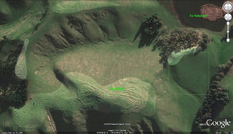
The above image shows the main section of the Pa and some of the more evident earthworks (lighter coloured areas) around the rim of the valley on the northern side of the pa. Not shown in the above are more areas further to the east around Lake Te Roto Kare and to the west.
It is likely that the pa was built well before the Ngati Kahungunu occupied the area, and that they took over (dispossessed) the previous inhabitants, the Ngati Hotu, of whom it is well documented, were more Caucasian in appearance than Polynesian. The square outline on the center right of the image above is the area shown in this next image below.
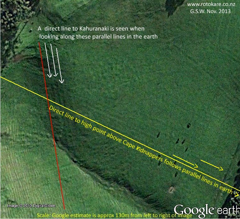
There are no claims made yet as to what the lines are or how long they have been there, but on sending an image a few years ago to Martin Doutre, the author of Ancient Celtic New Zealand' (1999), he suggested to look along the lines as they may well be surveying features aiming out to prominent landmarks.
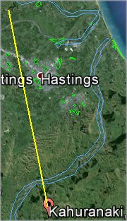
I did that, and found the parallel lines (following the red line) were aimed directly at Kahuranaki, some 25 kilometres distant. The slight ridges following the yellow line, aim toward Cape Kidnappers. If the lines also have anything to do with the seasonal positions of stars or planets it should be easy to then determine the age of the earthworks.
Assuming the site was built and used as an observatory, the earthworks would have been very prominent when first built, and would have since had at least five centuries of human activity around them prior to most likely being ploughed over in the late 1800's, and then of course the many hooves of horses, cattle and sheep over it.
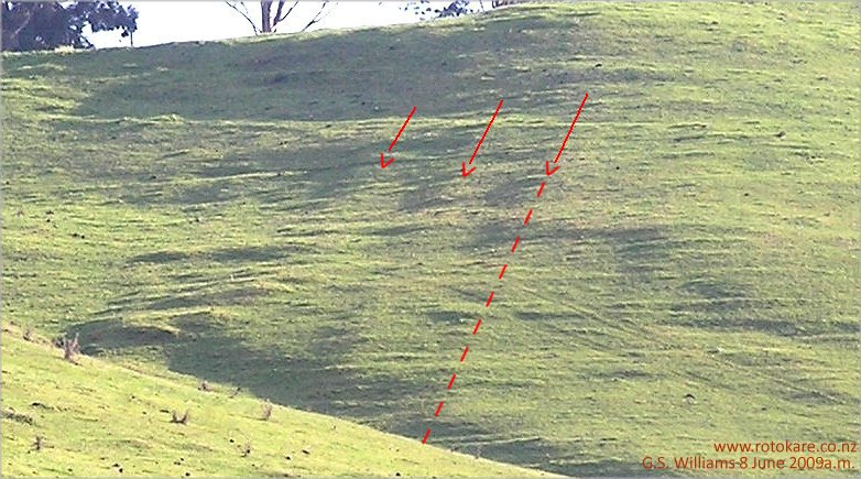
The image below is looking directly inland from the Korokipo Road, 350 meters distant.
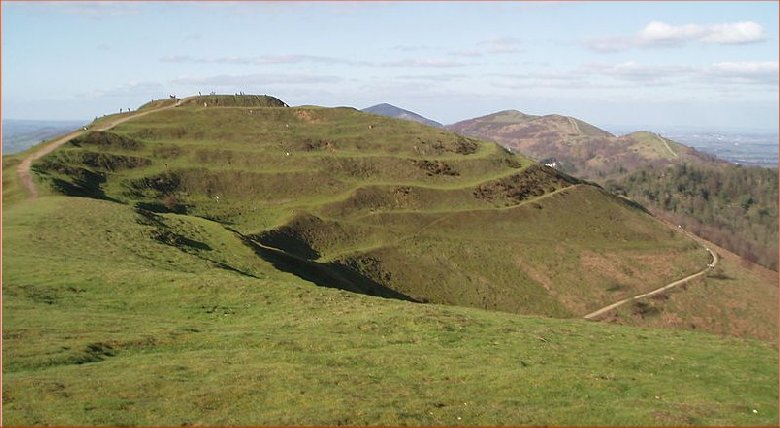
With regards the main pa itself; when genealogists, top Archaeologists from the U.K. and elsewhere, local Māori Land Court, and others have been here, the discussion without fail turns to similarities around Stonehenge and elsewhere in England. So here is another image (British Camp, Central Mound) below from Wikipedia, one of many images found on the internet from diferent sites. This one looks very amateurish in comparison with Oueroa.

When we eliminate the use of the words 'Māori' and 'Pakeha' in a manner that causes division in the mind; and take away the academics of politics and religion, then a whole different picture opens up as to who we really are and what has happened.
There is a very detailed and most interesting book entitled 'Ancient Celtic New Zealand' (1999) by Martin Doutre, who writes me regarding Oueroa Pa in 2010:
"...the area where you live was once occupied by the last known intact white tribe, called the Ngati Hotu....
...You're not too far from Poukawa where archaeologist Russell Price found evidence of human activity below the Waimahia ash-band layer (from the Waimahia volcanic explosion of 1350 BC)....
...The ordered parallel outlines that you mention could well be surveying features aiming out to prominent landmarks....
...It goes without saying that most so-called Māori PA's were simply inherited by the warriors as war prizes and that Māori had nothing to do with their original construction (only some latter, minor modifications for domestic living). ...Most of these so-called PA's were not defensive positions, but served as high trigs for surveying and overland mapping, as well as astronomical functions (especially as solar observatories). ...etc."
 It is surprising how deep, dark and mystical the events of history become when understanding is hidden, but with Oueroa and Google Earth, this Age coming into the Earth is lifting us out of the murk.
When writing this (2nd Nov 2013) I stood at the top of the parallel lines on the left of the image above, and they pointed exactly toward Kahuranaki, 25.3 kilometres in the distance. Drawing a line back from Kahuranaki, it falls exactly in line with the impressions shown above.
I hope it can be seen what is happening here. There are more unusual things in the above image than what I have pointed out, but what is interesting is that for decades I have stood on the Pa and looked at certain aspects of it with a knowledge that there was something more here than what has been traditional just a 'Māori Great Fleet Māori involvement.
1. Quoted from J.D.H. Buchanan's The Māori History & Place Names of Hawke's Bay, 1973.